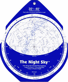
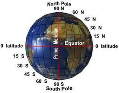
What's Out Tonight?  We began class with students sharing their observations of the night sky and measurements they had made using their astrolabes created in class last week. We discussed how to use a star chart and planisphere to find celestial objects in the night sky, based on your location and date. Several students that had gone out last week searching for the moon at night were surprised to discover that it was not visible. As was I! My apologies for not consulting my own star chart before giving the homework last week. The previous week's sky was illuminated by a beautiful full moon, however by mid-week last week the moon had nearly completed its monthly phase and turned to a new moon, which is not visible in the sky. Students did locate and measure the altitude of several bright stars, including Polaris. Jupiter and Venus are bright and visible this month, and Ursa Major (the "Big Dipper") is almost directly overhead. At the end of May and into June three planets - Mercury, Venus, Jupiter - will come together in a tight circle in the northwest sky and be visible without binoculars. You won't get the chance to see this again until 2026! I encourage students to continue to explore the night sky using a sky chart (HERE's one with specific information for May 2013), and spend some time becoming familiar with the location and movement of the celestial world surrounding them. Finding our Way Around  Students then worked together to complete Student Quest Guide page 79 on latitude and longitude. I had intended to spend only 10 or 15 minutes on this activity, but it soon became apparent that we needed a longer refresher to cement the concepts. Students should review the exercise to make sure they fully understand that latitude (parallels) run east-west but provide north-south measurements, while longitude (meridians) run north-south and provide east-west measurements. Students should also be able to identify specific locations on a map or globe using latitude and longitude coordinates. We discussed the location of 0 degrees latitude (Equator) and 0 degrees longitude (Prime Meridian at Greenwich, England). Recall too, that the distance between degrees of longitude decreases as you move north or south of the equator because the longitude lines become closer together. These are all concepts which seem readily apparent when we talk about them, but students need to practice using latitude and longitude on a map or globe to really digest the material and understand how this spherical coordinate system works.
Homework & Science Fair! For next week, students should read Chapters 23 and 24 and continue to work on their science fair projects.
Remember - we will be holding our in-class science fair on May 20th from 10:15 to 11:15 am in the dining hall (downstairs). Parents are invited to come view the displays and presentations. Comments are closed.
|
Categories
All
Archives
May 2016
|


 RSS Feed